 Geus Geonetworks metadata catalogue
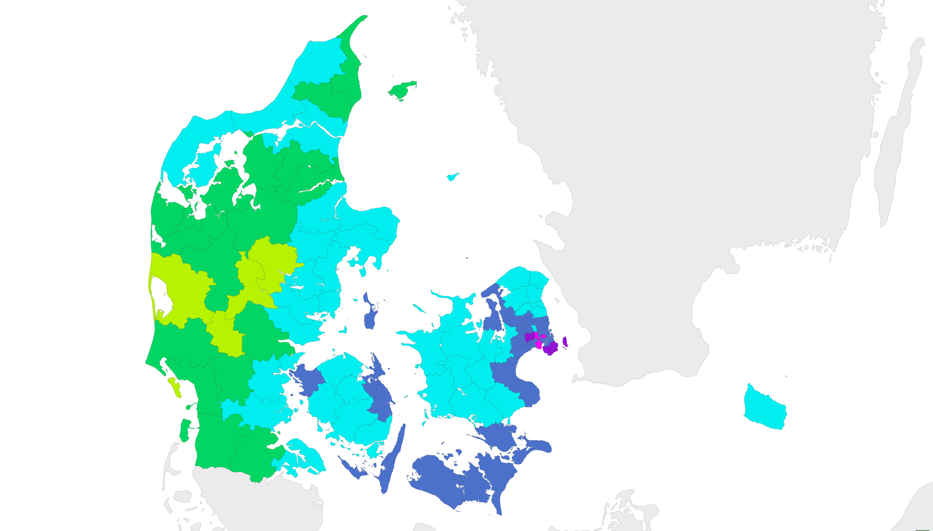
Hardness of Danish drinking water version (2010)
The map shows the hardness (dH) of the drinking water as an average of the hardness measured at the individual waterplants in 2010 in the municipalities. There can, however, be large differences in the hardness between the individual waterplant within the municipalities. In the average hardness calculations, the water production from the individual waterplants have been taken into acount to the extent that these data were reported by the municipality.
Simple
- Date (Publication)
- 2010-12-08
- Identifier
- dk.geus: / Drikkevands haardhed
- Presentation form
- Digital map
- Purpose
- The map shows the hardness of drinking water as reported in the Jupiter database in 2010.
- Status
- Obsolete
Point of contact
Geological Survey of Denmark and Greenland
-
Regarding inquiries
Øster Voldgade 10
,
København
,
1350 K
,
Danmark
- Maintenance and update frequency
- As needed
- GEMET - INSPIRE themes, version 1.0
-
- Geology
- Land use
- Keywords
-
- Drinking water
- Hardness
- Access constraints
- Copyright
- Use constraints
- Copyright
- Other constraints
- The map may be published with the consent of GEUS.
- Other constraints
- Conditions for re-use of data https://data.geus.dk/geusmap/terms_20140620.pdf
- Spatial representation type
- Vector
- Denominator
- 1000000
- Distance
- -1 m
- Metadata language
- dan
- Topic category
-
- Geoscientific information
- Environment
- Inland waters
N
S
E
W
))
- Reference system identifier
- EPSG / https://epsg.io/25832
- Geometric object type
- Complex
- Distribution format
-
-
Web Service
(
1.3.0
)
-
Web Service
(
1.3.0
)
Point of contact
Geological Survey of Denmark and Greenland (GEUS)
-
Bjarni Pjetursson
Øster Voldgade 10
,
København
,
1350 K
,
Danmark
- OnLine resource
-
Download
(
WWW:DOWNLOAD-1.0-http--download
)
Download datasets from GEUS' Dataverse
- Hierarchy level
- Dataset
Conformance result
- Date (Publication)
- 2010-12-08
- Explanation
- This field has no significance
- Pass
- No
- Statement
- The map is based on the hardness data reported to the Jupiter database by the end og 2010.
- File identifier
- 9674a55d-d46b-434f-8457-5e9356b93bad XML
- Metadata language
- dan
- Hierarchy level
- Dataset
- Date stamp
- 2024-09-20T10:11:20
- Metadata standard name
- ISO 19115:2003 / ISO 19139:2007
Point of contact
Geological Survey of Denmark and Greenland
-
Metadata contact person
Øster Voldgade 10
,
København
,
1350 K
,
Danmark
Overviews
Spatial extent
N
S
E
W
Provided by

Associated resources
Not available