 Geus Geonetworks metadata catalogue
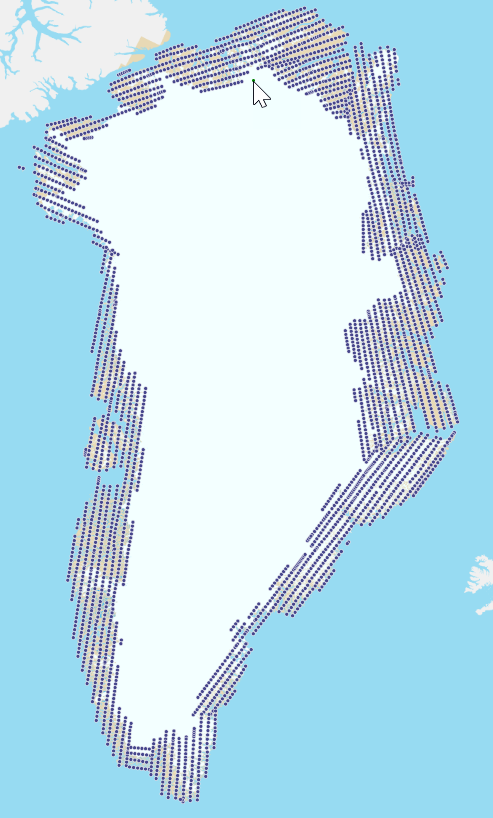
Vertical photos from Greenland 1:150 000
Uniform aerial photographic coverage of Greenland was achieved in 1978-1987 at 1: 150 000 scale by Mark Hurd Aerial Surveys, Inc., Minneapolis, Minnesota, U.S.A., for the Danish Geodetic Institute [Weidick, 1995]. The photography is now administered by the Danish Geodata Agency, see also http://eng.gst.dk/maps-topography/greenland/aerial-photos-of-greenland. The camera used for these black and white photographs was a Wild RC 10 with a super wide angle lens (focal length = 88 cm). The airplane used by Mark Hurd was a Gates Lear Jet 25C. By setting the flying height to app. 14 km the image scale of 1:150 000 was achieved [Bengtsson & Jørgensen, 1980]. In an attempt to avoid blind areas, caused by the precipitous mountainsides in combination with the use of a super wide angle lens, the photographs were taken with a length-lap of 80%, and a side-lap of 40%. In the subsequent use of the photography (for aerotriangulation, mapping and scanning) generally only every other image were used (as you will see from the photo number shown on this web-page). The photo center coordinates are from the aerotriangulation by the Danish Geodata Agency.
Please contact GST for the high resolution photos.
Simple
- Date (Revision)
- 2023-12-03
- Identifier
- dk.geus: / vertical_photo
- Presentation form
- Digital map
- Purpose
- Non provided.
- Status
- Completed
- Maintenance and update frequency
- As needed
- GEMET - INSPIRE themes, version 1.0
-
- Geology
- Keywords
-
- Vertical photos
- Continents, countries, sea regions of the world.
-
- Greenland
- Access constraints
- Copyright
- Use constraints
- Copyright
- Other constraints
- These photos are the property of the Danish Geodata Agency. We (GEUS) have kindly been allowed to publish these on the web in a low resolution version.
- Other constraints
- Conditions for Re-use of data https://data.geus.dk/geusmap/terms_20140620.pdf
- Spatial representation type
- Vector
- Spatial representation type
- Grid
- Denominator
- 150000
- Distance
- -1 m
- Metadata language
- English
- Topic category
-
- Geoscientific information
))
- Reference system identifier
- EPSG / https://epsg.io/32624
- Geometric object type
- Point
- Distribution format
-
-
Web Service
(
1.0
)
-
Web Service
(
1.0
)
- OnLine resource
- Interactive map ( WWW:LINK-1.0-http--link )
- Hierarchy level
- Dataset
Conformance result
- Date (Publication)
- 2010-12-08
- Explanation
- This field has no significance
- Pass
- No
- Statement
- Non provided.
- File identifier
- 7fc152da-aec8-49a5-9eb0-64f8bb981128 XML
- Metadata language
- English
- Hierarchy level
- Dataset
- Date stamp
- 2023-04-13T12:38:41
- Metadata standard name
- ISO 19115:2003 / ISO 19139:2007
Overviews
Spatial extent
Provided by
