 Geus Geonetworks metadata catalogue
Nitrat
Type of resources
Available actions
Topics
Keywords
Contact for the resource
Provided by
Years
Formats
Representation types
Update frequencies
status
Scale
Resolution
-
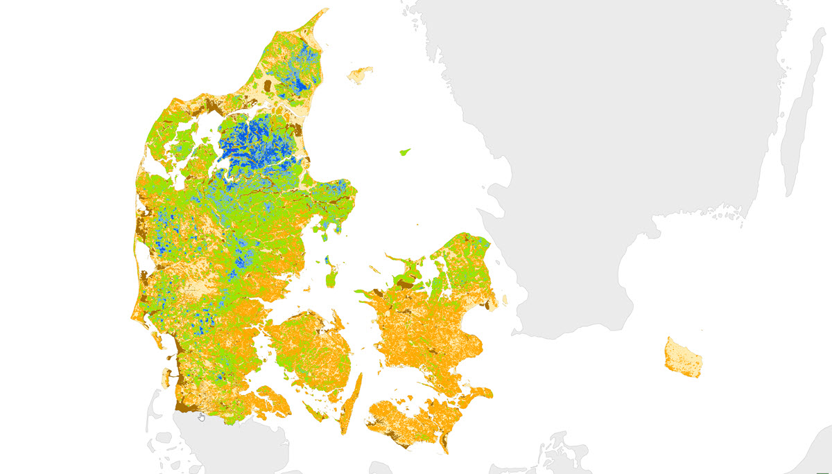
This map is the first national map showing the depth in meters to the uppermost redox interface in sediments of Quaternary age. The redox interface indicates the transition from the oxidized to the reduced geochemical environment in sediments. The redox interface was identified according to the colors of the sediments in 11,999 wells and is shown for 1x1 km grid-cells. For grid-cells with multiple site information, the depth to the redox interface is indicated by an average value. For grid-cells without any field information, the depth of the redox interface was established based on information about 1) geological setting, 2) morphology, 3) depths to redox boundaries at nearby field sites, 4) GEUS surface geology map, 5) topography, and 6) the pre-quaternary surface. The method for this first national redox-map and the data used is described in GEUS report no. 93 (2006) entitled Beregning af nitrat-reduktionsfaktorer for zonen mellem rodzonen og frem til vandløbet. Data og metode for 1.generationskortet (in Danish). The Redox map is also described in Vand og Jord (2011) 18: 37-39 (in Danish).
-
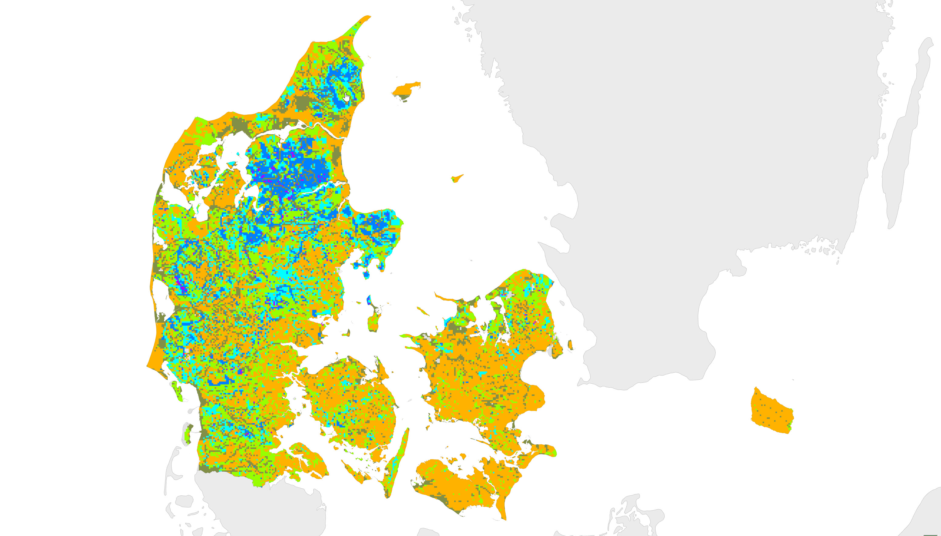
The map illustrates depth to the redox interface in meters below ground. The interface marks the transition from oxidised to reduced conditions in the subsurface. Based on approx. 13.000 observations of colour changes in sediment cores, a model has been developed describing relations between explanatory variables and depth to the redox interface. The machine learning method random forest has been used to develop the model. The map shows the best estimate of the location of the interface in a 100 m grid resolution. The applied method additional provides an estimate of the uncertainty. The method is described further in: Koch J, Stisen S, Refsgaard JC, Ernstsen V, Jakobsen PR, Højberg AL (2019) Modelling depth of the redox interface at high resolution at national scale using Random Forest and residual Gaussian simulation, Water Resour. Res., https://doi.org/10.1029/2018WR023939 Koch J, Stisen S, Refsgaard JC, Ernstsen V, Jakobsen PR, Højberg AL (2019) Nyt nationalt redoxkort i høj opløsning. In Tema: TReNDS. Vand & Jord, 26 (1), 26-29.