 Geus Geonetworks metadata catalogue
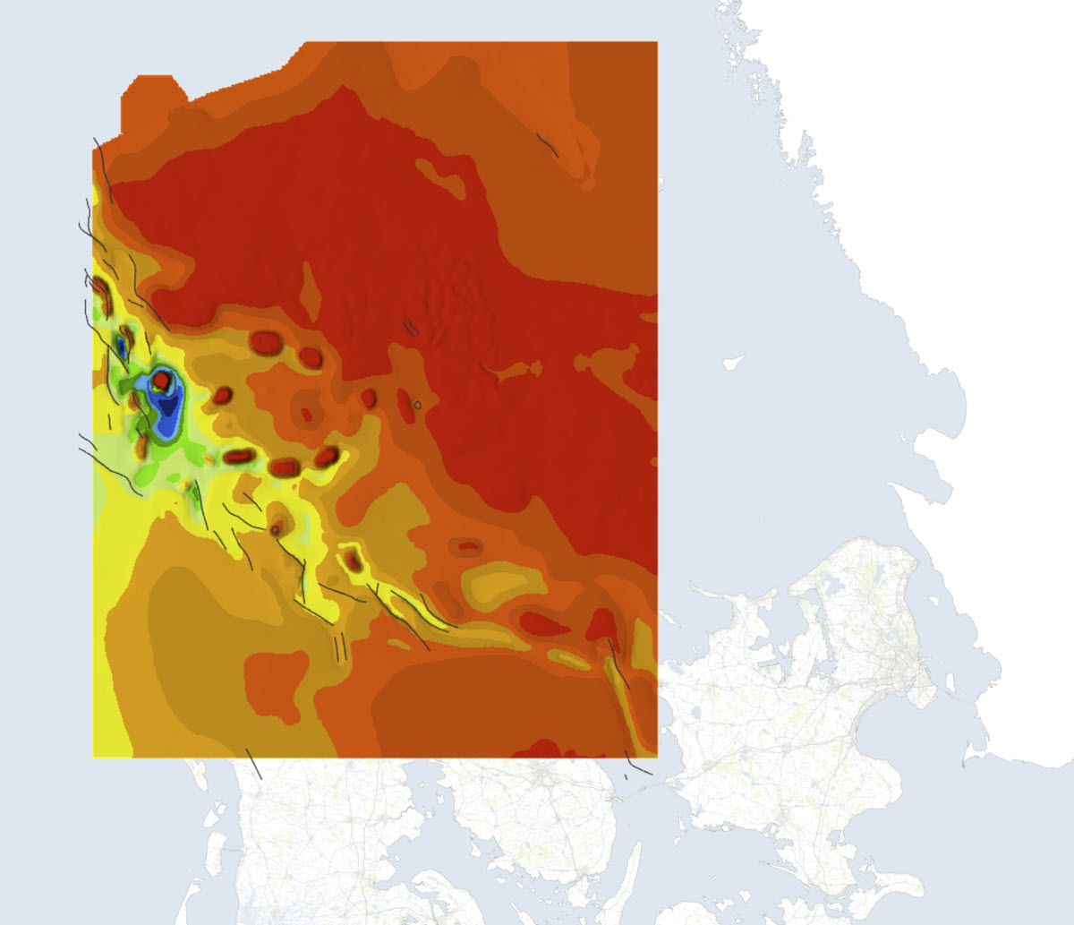
Geological map of Denmark, 1:400 000. The Danish Basin. 'Top Chalk'
The map is based on selected seismic data up to 2001. The map shows the structural conditions at depth for the 'Top Kalk' surface, from the central to the eastern part of the Danish North Sea. 'Top Kalk' denotes the surface which forms the basis of the Tertiary deposits (except Denmark).
The map is described in GEUS Bulletin No. 13. 2007.
Simple
- Date (Revision)
- 2007-01-01
- Identifier
- dk.geus: / DB_TopKalk
- Presentation form
- Digital map
- Status
- Completed
Point of contact
Geological Survey of Denmark and Greenland
-
Regarding inquiries
Øster Voldgade 10
,
København
,
1350 K
,
Danmark
- Maintenance and update frequency
- As needed
- GEMET - INSPIRE themes, version 1.0
-
- Geology
- Elevation
- Keywords
-
- Top Chalk
- Access constraints
- Copyright
- Use constraints
- Restricted
- Other constraints
- The map may be published with the consent of GEUS
- Other constraints
- Conditions for re-use of data https://data.geus.dk/geusmap/terms_20140620.pdf
- Spatial representation type
- Grid
- Denominator
- 400000
- Distance
- 500 m
- Metadata language
- dan
- Topic category
-
- Geoscientific information
- Elevation
N
S
E
W
))
- Reference system identifier
- EPSG / https://epsg.io/25832
- Geometric object type
- Complex
- Distribution format
-
-
Web Service
(
1.3.0
)
-
Web Service
(
1.3.0
)
Distributor
Geological Survey of Denmark and Greenland
-
Christian Brogaard Pedersen
Øster Voldgade 10
,
København
,
1350 K
,
Danmark
- OnLine resource
-
Denmark's Geology Portal
(
WWW:LINK-1.0-http--link
)
GEUS' web portal for geological maps of Denmark
- Hierarchy level
- Dataset
Conformance result
- Date (Publication)
- 2010-12-08
- Explanation
- This field has no significance
- Pass
- No
- Statement
- The map is the result of a combined geological and geophysical interpretation of all data collected before 1990. In addition to information from the deep boreholes in the area, it is an interpretation of 20,000 km of reflection-seismic recordings.
- File identifier
- fd641e8e-90cf-435f-a003-c3d7a74f982a XML
- Metadata language
- dan
- Hierarchy level
- Dataset
- Date stamp
- 2023-10-24T14:06:29
- Metadata standard name
- ISO 19115:2003 / ISO 19139:2007
Point of contact
Geological Survey of Denmark and Greenland
-
Metadata contact person
Øster Voldgade 10
,
København
,
1350 K
,
Danmark
Overviews
Spatial extent
N
S
E
W
Provided by

Associated resources
Not available