 Geus Geonetworks metadata catalogue
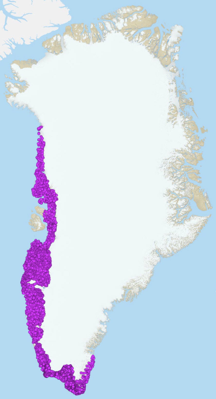
Geochemical Atlas samples South-West Greenland
This view presents data from stream sediment geochemical mapping of West and South Greenland (Steenfelt, 2001a). Stream sediment samples were collected from 1979 to 1998 with as even coverage as possible from low-order streams and with a sampling density of mostly around 1 sample per 30 km2 but up to 1 sample per 5 km2 in parts of South Greenland. The 0.1 mm grain size fractions of 500-g samples were analysed for major and trace elements by two or three methods. After careful quality control, selection of the most reliable analytical data and elimination of analytical bias (calibration), the final consistent dataset, named batch 2005, contains data from 7122 samples analysed for up to 43 elements (see Steenfelt 1999, 2001b for details on data selection and calibration). In batch 2005, values below lower detection limit are indicated by the digit 0.
Sample location
Before 1997, sample sites were originally marked on topographic maps at the scale 1:100,000 and their positions were later digitised and later again corrected, when a new topographic reference was introduced around year 2000. From 1997 onwards, GPS was used to determine sample positions.
Simple
- Date (Revision)
- 2019-01-01
- Identifier
- dk:geus: / geochemical_atlas_sw_greenland
- Presentation form
- Digital map
- Status
- Completed
- Maintenance and update frequency
- As needed
- GEMET - INSPIRE themes, version 1.0
-
- Geology
- Mineral resources
- Keywords
-
- Calibrated dataset
- Continents, countries, sea regions of the world.
-
- Greenland
- Access constraints
- Copyright
- Use constraints
- Copyright
- Other constraints
- Public access / The dataset can be used freely when acknowledged
- Other constraints
- Conditions for Re-use of data http://pubs.geus.net/et_dokument
- Spatial representation type
- Vector
- Spatial representation type
- Grid
- Denominator
- 1
- Distance
- 1 m
- Metadata language
- English
- Topic category
-
- Geoscientific information
- Location
))
- Reference system identifier
- EPSG / https://epsg.io/32624
- Geometric object type
- Point
- Distribution format
-
-
Web Service
(
1.0
)
-
Web Service
(
1.0
)
- OnLine resource
- Interactive map ( WWW:LINK-1.0-http--link )
- OnLine resource
-
Publication
(
WWW:LINK-1.0-http--link
)
Steenfelt, A., 2001a. Geochemical atlas of Greenland – West and South Greenland. Danmarks og Grønlands Geologiske Undersøgelse Rapport 2001/46, 96 pp.
- OnLine resource
-
Publication
(
WWW:LINK-1.0-http--link
)
Agnete Steenfelt (1999) Compilation of data sets for a geochemical atlas of West and South Greenland based on stream sediment Danmarks og Grønlands Geologiske Undersøgelse Rapport 41
- OnLine resource
-
geochemistry_stream_svgrl
(
OGC:WMS-1.3.0-http-get-map
)
Geochemical data packages - Stream sediments SV Grl
- OnLine resource
-
WFS
(
OGC:WFS-1.0.0-http-get-capabilities
)
South West Greenland stream sediments
- OnLine resource
-
Publication
(
WWW:LINK-1.0-http--link
)
Steenfelt, A., 2001. Calibration of stream sediment data for West and South Greenland. A supplement to GEUSReport 1999/41
- OnLine resource
-
Download
(
WWW:DOWNLOAD-1.0-http--download
)
Download as GIS shapefile
- Hierarchy level
- Dataset
Conformance result
- Date (Publication)
- 2010-12-08
- Explanation
- This field has no significance
- Pass
- No
- Statement
- Non provided
- File identifier
- 8abf8aef-e244-4f70-9c48-a455cf4c32ae XML
- Metadata language
- English
- Date stamp
- 2023-04-13T12:47:54
- Metadata standard name
- ISO 19115:2003 / ISO 19139:2007
Overviews
Spatial extent
Provided by
