 Geus Geonetworks metadata catalogue
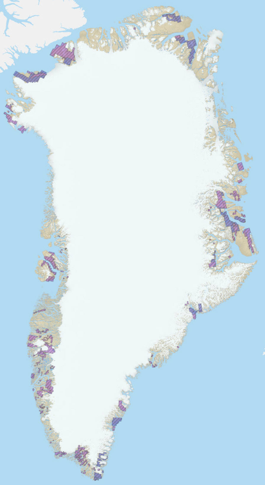
Historical licences
Simple
- Date (Revision)
- 2022-01-01
- Identifier
- dk.geus: / grl_lic_minerals_historical
- Presentation form
- Digital map
- Purpose
- To show historical licence areas in Greenland.
- Status
- On going
- Maintenance and update frequency
- As needed
- GEMET - INSPIRE themes, version 1.0
-
- Geology
- Keywords
-
- Mineral exploration licences
- Protected areas
- Access constraints
- Copyright
- Use constraints
- Copyright
- Other constraints
- No limitations on public access
- Spatial representation type
- Vector
- Denominator
- 100000
- Distance
- 100 m
- Metadata language
- English
- Topic category
-
- Geoscientific information
- Economy
))
- Reference system identifier
- EPSG / https://epsg.io/32624
- Geometric object type
- Surface
- Distribution format
-
-
Web Service
(
0.1
)
-
Web Service
(
0.1
)
- OnLine resource
-
MLSA:mcas_mlsa_public_applications
(
OGC:WFS-1.0.0-http-get-capabilities
)
MLSA:MCAS public applications
- OnLine resource
-
Interactive map
(
WWW:LINK-1.0-http--link
)
Greenland Portal
- OnLine resource
-
Interactive map
(
WWW:LINK-1.0-http--link
)
Minerals and Petroleum licence map
- OnLine resource
-
Mineral Resources Act
(
WWW:LINK-1.0-http--link
)
The Mineral Resources Act is the framework legislation for all activities related to mineral and hydrocarbon exploration and exploitation.
- OnLine resource
-
grl_lic_protected_areas
(
OGC:WMS-1.3.0-http-get-map
)
Greenland licenses - Applications for new license
- Hierarchy level
- Dataset
Conformance result
- Date (Publication)
- 2010-12-08
- Explanation
- This field has no significance
- Pass
- No
- Statement
- Data are retrieved through the WFS provided by MMR and then re-distributed through GEUS mapserver setup. No changes to the data are made.
- File identifier
- 7e2e5437-9945-4bfe-b4ea-72a1e42f464d XML
- Metadata language
- English
- Hierarchy level
- Dataset
- Date stamp
- 2023-04-12T12:02:20
- Metadata standard name
- ISO 19115:2003 / ISO 19139:2007
Overviews
Spatial extent
Provided by
