 Geus Geonetworks metadata catalogue
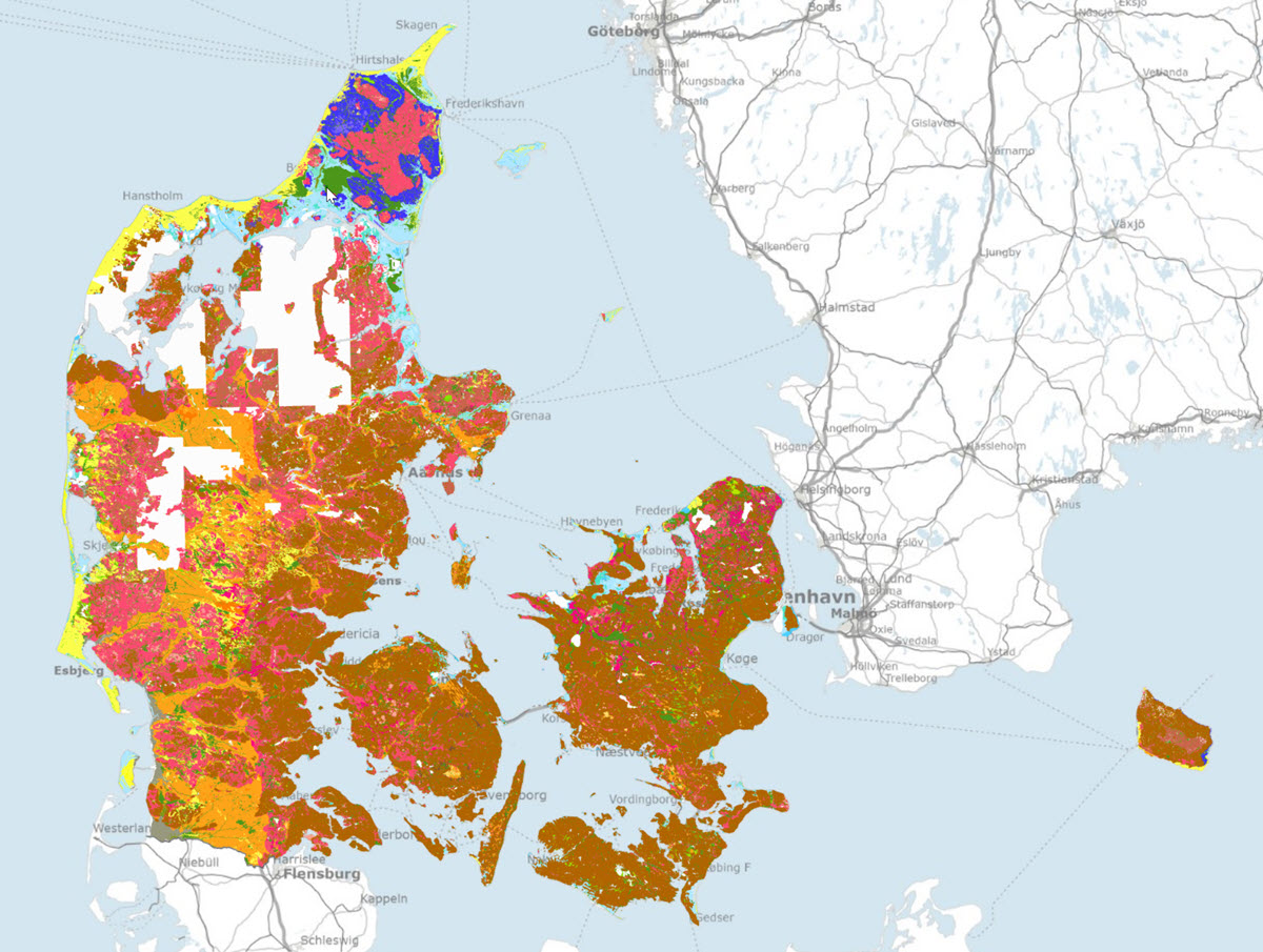
Geological surface map of Denmark 1:25.000, version 6
Simple
- Date (Publication)
- 2022-05-12
- Identifier
- dk.geus: / Jordartskort_25000
- Presentation form
- Digital map
- Status
- On going
- Maintenance and update frequency
- As needed
- GEMET - INSPIRE themes, version 1.0
-
- Geology
- Keywords
-
- Surface geology
- Access constraints
- Copyright
- Use constraints
- Copyright
- Other constraints
- No limitations on public access
- Other constraints
- Conditions for re-use of data https://data.geus.dk/geusmap/terms_20140620.pdf
- Spatial representation type
- Vector
- Denominator
- 25000
- Distance
- -1 m
- Metadata language
- dan
- Topic category
-
- Geoscientific information
- Imagery base maps earth cover
))
- Reference system identifier
- EPSG / https://epsg.io/25832
- Geometric object type
- Complex
- Distribution format
-
-
Web Service
(
1.3.0
)
-
Web Service
(
1.3.0
)
- OnLine resource
-
Report
(
DOI
)
Jakobsen, P.R., Tougaard, L. & Anthonsen, K.L. (2021): Danmarks Digitale Jordartskort 1:25 000 version 6.0. Danmarks og Grønlands Geologiske Undersøgelse Rapport 2021/68, 30 pp.
- OnLine resource
-
Denmark's Geology Portal
(
WWW:LINK-1.0-http--link
)
GEUS' web portal for geological maps of Denmark
- OnLine resource
-
Download
(
WWW:DOWNLOAD-1.0-http--download
)
Download dataset from GEUS' Dataverse
- OnLine resource
-
Webservice
(
OGC:WMTS-1.0.0-http-get-capabilities
)
Web service for the dataset
- OnLine resource
-
Webservice
(
OGC:WMS-1.3.0-http-get-capabilities
)
Web service for the dataset
- Hierarchy level
- Dataset
Conformance result
- Date (Publication)
- 2010-12-08
- Explanation
- This field has no significance
- Pass
- No
- Statement
- The surface geology of Denmark has been mapped by DGU / GEUS since 1888. Digitisation, editing and updating of the map is carried out by the GIS group at GEUS. This version of the map covers about 91 % of Denmark and is supplemented in an ongoing process.
- File identifier
- 71d1d132-d6d2-4f02-9063-31a495e05b1d XML
- Metadata language
- dan
- Hierarchy level
- Dataset
- Date stamp
- 2025-02-27T13:51:07
- Metadata standard name
- ISO 19115:2003 / ISO 19139:2007
Overviews
Spatial extent
Provided by
