 Geus Geonetworks metadata catalogue
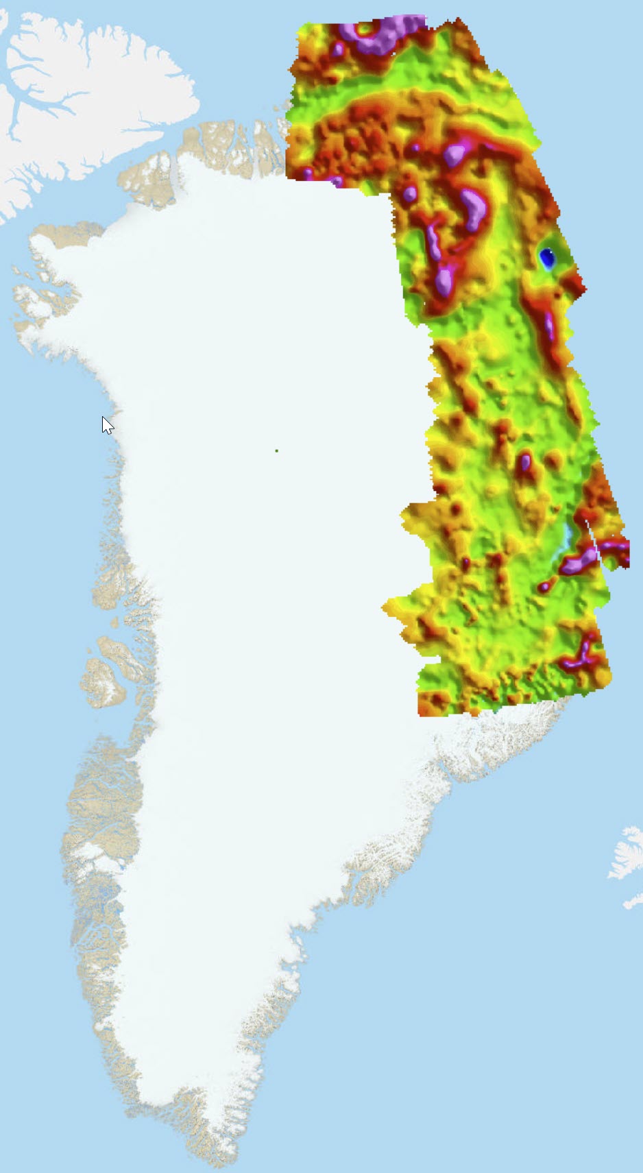
AWI-AEROMAG 93-96
Simple
- Date (Revision)
- 2020-01-24
- Identifier
- dk.geus: / grl_geophysical_aeromag_awi_compilation
- Presentation form
- Digital map
- Status
- Completed
- Maintenance and update frequency
- As needed
- GEMET - INSPIRE themes, version 1.0
-
- Geology
- Keywords
-
- Aeromagnetic
- Total magnetic intensity
- Continents, countries, sea regions of the world.
-
- Greenland
- Access constraints
- Copyright
- Use constraints
- Copyright
- Other constraints
- Conditions for Re-use of data https://data.geus.dk/geusmap/terms_20140620.pdf
- Spatial representation type
- Grid
- Denominator
- 100000
- Distance
- 100 m
- Metadata language
- English
- Topic category
-
- Geoscientific information
))
- Reference system identifier
- EPSG / https://epsg.io/32624
- Geometric object type
- Complex
- Distribution format
-
-
Web Service
(
1.0
)
-
Web Service
(
1.0
)
- OnLine resource
-
Publication
(
WWW:LINK-1.0-http--link
)
Aeromagnetic study of the continental crust of northeast Greenland
- OnLine resource
-
AWI_all_Aeromag93_96_ln
(
OGC:WMS-1.3.0-http-get-capabilities
)
AWI_all_Aeromag93_96_ln
- OnLine resource
-
Publication
(
WWW:LINK-1.0-http--link
)
Architecture and evolution of the continental crust of East Greenland from integrated geophysical studies
- OnLine resource
-
Interactive map
(
WWW:LINK-1.0-http--link
)
Greenland Portal
- Hierarchy level
- Dataset
Conformance result
- Date (Publication)
- 2010-12-08
- Explanation
- This field has no significance
- Pass
- No
- Statement
- Magnetic maps are based on data acquired and processed in the 90s. The acquisition pattern with sparse and irregular line spacing from 5 to 40 km results into a rather low spatial resolution such the use of these data is mainly limited to regional studies. Data quality is limited since flights were partly acquired in periods with distinct geomagnetic activities and with the larger distances to the next magnetic reference station (stations at Zackenberg, Constable Point and Station Nord were used). However, recent reprocessing (2019) with modern leveling methods has improved the data quality by reducing levelling artefacts.”
- File identifier
- 6ef64ae8-2066-4a6c-8c98-bffa19993048 XML
- Metadata language
- English
- Hierarchy level
- Dataset
- Date stamp
- 2023-09-08T14:12:50
- Metadata standard name
- ISO 19115:2003 / ISO 19139:2007
Overviews
Spatial extent
Provided by
