 Geus Geonetworks metadata catalogue
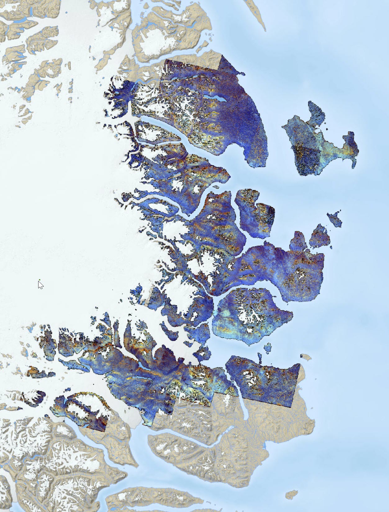
Northeast Greenland Aster Data
A series of Aster band ratios highlighting mineral distributions. Band ratio color composite images to distinguish variability of lithology in the area. Preprocessing of the Aster scenes encompasses atmospheric, radiometric and topographic corrections before masking non-outcrop pixels and generating the final mosaic. The calibrated radiance data is converted to apparent surface reflectance using a radiative transfer program, Atmospheric and Topographic Correction (ATCOR-3), in rugged terrain mode. The ATCOR rugged terrain mode utilizes a surface elevation model to adjust illumination levels. Calibration and adjusting the apparent surface reflectance values from the ATCOR-3 processing was not feasible due to lack of ground-based reflectance measurements.
Simple
- Date (Publication)
- 2019-03-01
- Identifier
- dk.geus: / neg_aster
- Presentation form
- Digital map
- Status
- Completed
Distributor
Geological Survey of Denmark and Greenland (GEUS)
-
Christian Brogaard Pedersen
Oster Voldgade 10
,
Copenhagen
,
1350 K
,
Denmark
- Maintenance and update frequency
- As needed
- GEMET - INSPIRE themes, version 1.0
-
- Geology
- Keywords
-
- Aster
- Continents, countries, sea regions of the world.
-
- Greenland
- Access constraints
- Copyright
- Use constraints
- Copyright
- Other constraints
- No limitations on public access
- Other constraints
- Conditions for Re-use of data https://data.geus.dk/geusmap/terms_20140620.pdf
- Spatial representation type
- Grid
- Denominator
- 50000
- Distance
- 15 m
- Metadata language
- English
- Topic category
-
- Geoscientific information
N
S
E
W
))
- Reference system identifier
- EPSG / https://epsg.io/32624
- Geometric object type
- Complex
- Distribution format
-
-
Web Service
(
1.0
)
-
Web Service
(
1.0
)
Point of contact
Geological Survey of Denmark and Greenland (GEUS)
-
Christian Brogaard Pedersen
Oster Voldgade 10
,
Copenhagen
,
1350 K
,
Denmark
- OnLine resource
-
Data source
(
WWW:DOWNLOAD-1.0-http--download
)
USGS Earth Explorer download page
- OnLine resource
-
Interactive map
(
WWW:LINK-1.0-http--link
)
Greenland Portal
- Hierarchy level
- Dataset
Conformance result
- Date (Publication)
- 2010-12-08
- Explanation
- This field has no significance
- Pass
- No
- Statement
- The ASTER Level 1 Precision Terrain Corrected Registered At-Sensor Radiance (AST_L1T) data are obtained from the USGS webpage https://earthexplorer.usgs.gov/ in the time period of 2000-2007. Scenes were also limited to summer and captured in daytime.
- File identifier
- 53661d2a-6cd7-4f72-82d7-a01db028bf04 XML
- Metadata language
- English
- Hierarchy level
- Dataset
- Date stamp
- 2023-04-13T11:47:22
- Metadata standard name
- ISO 19115:2003 / ISO 19139:2007
Point of contact
Geological Survey of Denmark and Greenland (GEUS)
-
Metadata contact person
Oster Voldgade 10
,
Copenhagen
,
1350 K
,
Denmark
Overviews
Spatial extent
N
S
E
W
Provided by

Associated resources
Not available