 Geus Geonetworks metadata catalogue
Geochronology data
Simple
- Date (Revision)
- 2022-01-01
- Identifier
- dk.geus: / geochronology
- Presentation form
- Digital map
- Purpose
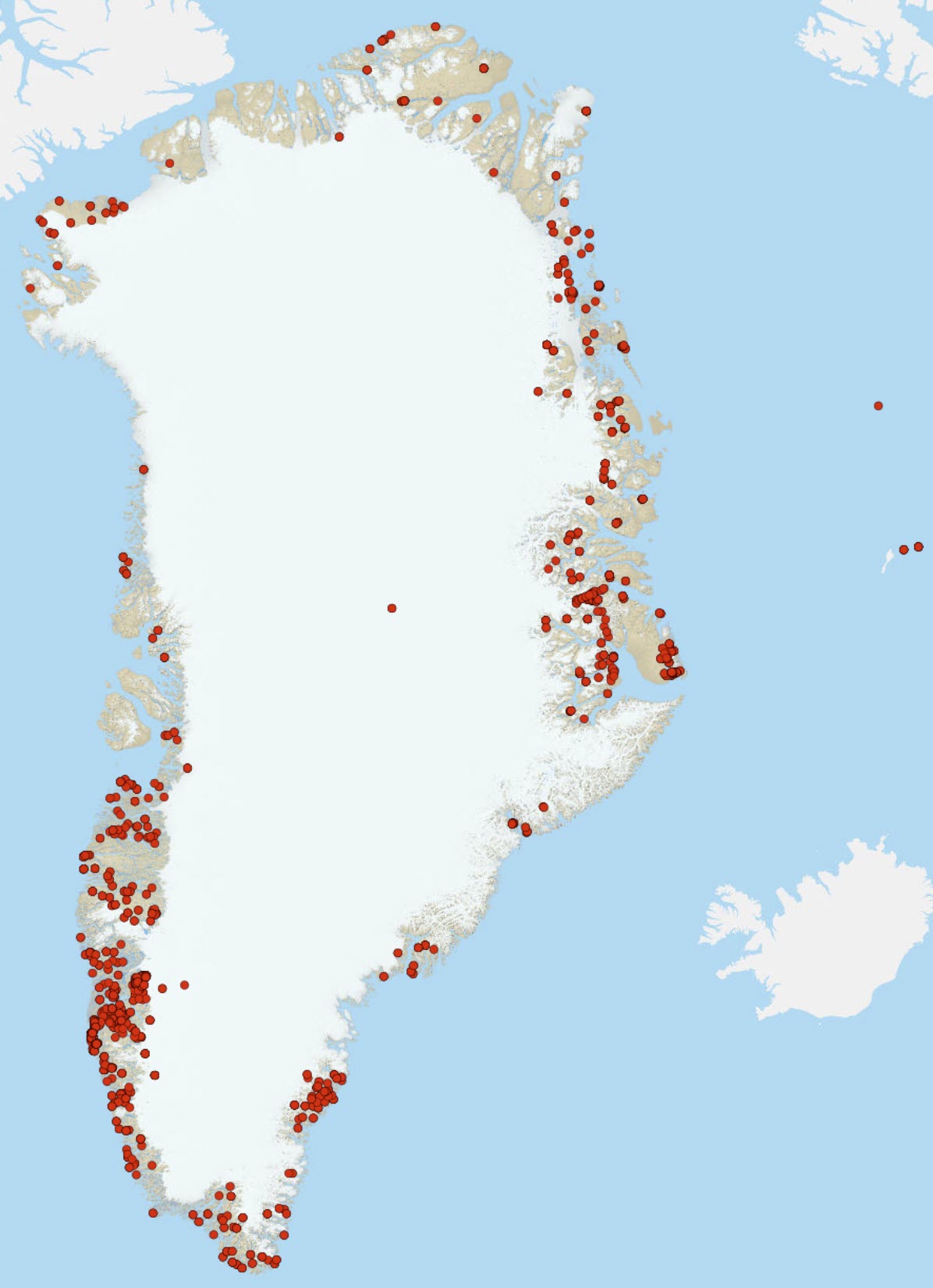
- the database collates information scattered widely across published sources making this information vastly more accessible.
- Status
- Completed
- Maintenance and update frequency
- As needed
- GEMET - INSPIRE themes, version 1.0
-
- Geology
- Keywords
-
- geochronology
- Continents, countries, sea regions of the world.
-
- Greenland
- Access constraints
- Copyright
- Use constraints
- Copyright
- Other constraints
- No limitations on public access
- Other constraints
- Conditions for Re-use of data http://pubs.geus.net/et_dokument
- Spatial representation type
- Vector
- Spatial representation type
- Grid
- Denominator
- 200
- Distance
- 100 m
- Metadata language
- English
- Topic category
-
- Geoscientific information
))
- Reference system identifier
- EPSG / https://epsg.io/32624
- Geometric object type
- Complex
- Distribution format
-
-
shape file
(
0.1
)
-
shape file
(
0.1
)
- OnLine resource
- interactive map ( WWW:LINK-1.0-http--link )
- OnLine resource
-
geochron
(
OGC:WMS-1.1.1-http-get-map
)
Geochronology (MMR)
- OnLine resource
-
Download
(
WWW:DOWNLOAD-1.0-http--download
)
Download as GIS shapefile
- OnLine resource
-
Publication
(
WWW:LINK-1.0-http--link
)
Dataset description
- Hierarchy level
- Dataset
Conformance result
- Date (Publication)
- 2010-12-08
- Explanation
- This field has no significance
- Pass
- No
- Statement
-
Data is captured from a wide range of published literature sources and stored in multiple linked tables using a Globally Unique IDentifier (GUID) for each sample, a unique reference number used as a means of directly locating a specific record. The primary level of information for each sample is sample identification (as provided by the referenced literature source), source reference, location, lithological features, mineral type, analytical technique, pooled age information and individual analysis-level age information. All original data sources are referenced in the database using the Harvard referencing style to allow easy location of the original data source through internet searching. If a specific ratio, age, or other variable has not been provided in the original source it is not derived in this database. In all cases the information captured has aimed to remain faithful to the original source geological interpretation and information, the only exception being sample location where samples with a missing location or otherwise mis-located have been assigned a grid reference through Google EarthTM. The table structure is designed to ensure referential integrity i.e. to ensure that typographic errors are minimised through the use of lookup tables for specific fields.
Two levels of age information are held within the database, namely Pooled Ages and Individual Ages. Pooled Ages refer to weighted mean ages or other statistical age groupings where multiple analyses are considered together to define the age of a geological event. A single sample can have multiple Pooled Ages and hence multiple interpretations thereof. For example, a single sample may yield younger metamorphic overgrowths on older igneous crystals, and therefore a Pooled Age of each crystal domain is possible and would yield more information from this sample than just a single date.
Location: Location is either captured from the source itself, or where not given is captured via Google EarthTM.
Locations are given in decimal degrees.
Reference: Reference of the original data source in Harvard format.
Lithology; a free text field as defined by the source author describing the sampled rock. Rock type; a pre-defined choice of rock classification e.g. igneous, metamorphic and sedimentary and derivatives thereof. Terrane and unit information based on spatial join with a terrane map of Greenland based in large part on Dawes (2009).
Pooled ages and statistical information: A one-to-many relationship with the sample, this structure holds the statistical information about a pooled age (e.g. age, uncertainty and MSWD) along with interpretation of the pooled age (looked up) and the approach (looked up). The approach defines the isotopic ratio or the ratios used to calculate the pooled age.
Individual ages and ratios: This structure holds the spot level or grain level isotopic information (U-Pb, Pb-Pb ratios and corresponding uncertainties at the 1 sigma level) and derived dates. We have applied a simple analysis-level classification system which aims to be consistent with the original interpretation; this scheme aids in the utility of datasets and allows easy compilation. D = outside discordance threshold or age information regarded as geologically meaningless; M = metamorphic; I = magmatic; X = xenocryst / inheritance; S = detrital. The spot level ID is a simplified scheme as discussed in Spencer et al., (2015) and used by the Geological Survey of Western Australia (Wingate and Kirkland, 2015). All analyses are common Pb corrected.
- File identifier
- 327f1533-9c9d-4707-8451-7aa68ba37ba3 XML
- Metadata language
- English
- Hierarchy level
- Dataset
- Date stamp
- 2023-04-13T12:29:49
- Metadata standard name
- ISO 19115:2003 / ISO 19139:2007
Overviews
Spatial extent
Provided by
